Originating from the Himachal range in Nepal, the Mechi river forms the boundary between Nepal and India. Far in the east, River Sankosh rises in Bhutan and flows through India along the state borders of West Bengal and Assam. In the area stretching between these two rivers lies the Eastern Dooars Elephant Reserve (EDER), 1659sq.km. of forests interspersed with tea gardens and farmland. River Teesta flows through the reserve, dividing it into two regions, Terai on the left and Dooars on the right. Situated in West Bengal, the reserve's elephant zones are distributed within the districts of Darjeeling, Kalimpong, Jalpaiguri, Cooch Behar and Alipurduar. The area is so vast that it houses six different protected areas: Mahananda WLS, Chapramari WLS, Jaldapara National Park, Gorumara National Park, Buxa Tiger Reserve and Jayanti Tiger Reserve.
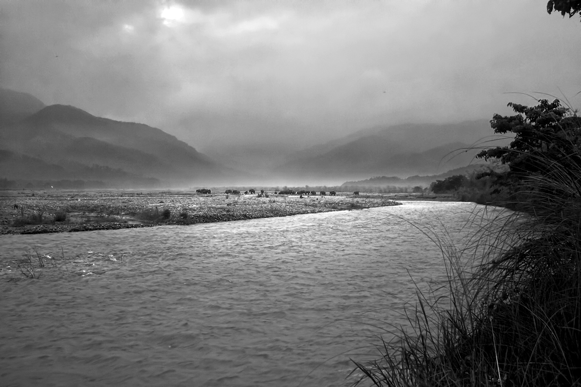
The Sankosh to Mechi or east-west elephant movement route is an ancient one and was first documented during the colonial era. There are several old records of the same, but the most valuable one was observed by O’Malley in 1905 when he noticed the movement of an individual herd from Sankosh to Mechi, travelling from the Dooars region and entering the Terai stretch via the Teesta river. According to the forest department records, the Teesta-Sankosh Dooars stretch is an elephant concentration zone with several protected areas, whereas the Teesta-Mechi Terai stretch is more challenging with a high density of human habitations.
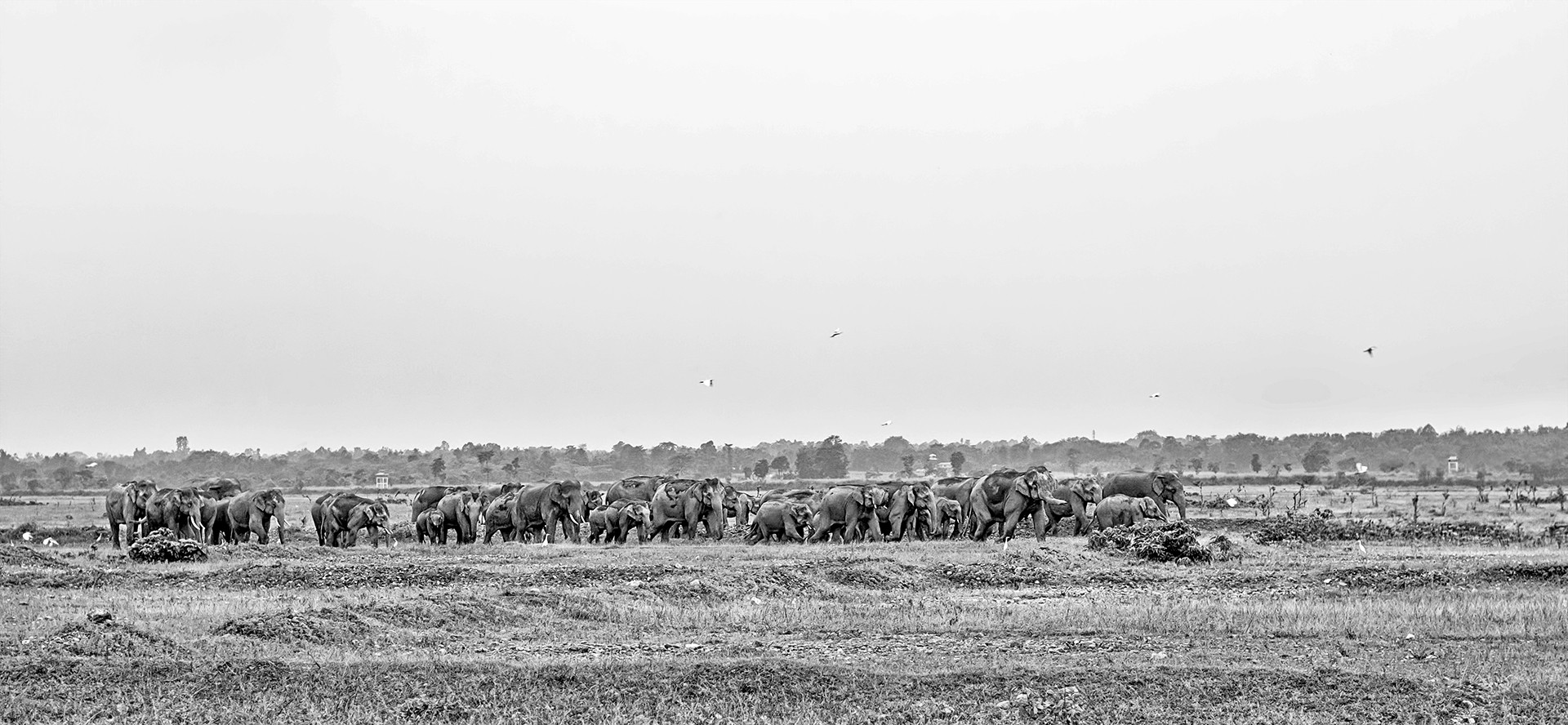
The Teesta-Mechi Terai stretch has a number of issues that influence a negative relationship between humans and elephants, but the most pertinent among them is the Indo-Nepal conflict. If you look at historical records, there has been no conflict along the Teesta-Mechi stretch. A large part of it is covered by several patches of forest including the protected areas of the Mahananda WLS. Much of this area falls under the Baikunthapur and Kurseong territorial divisions, and elephant movement patterns here have a century-old history. Records from the British period show that elephants were using this stretch throughout the year. There were two different congregations in this landscape, one in the winter at the Teesta chaar (riverbank) and one at the Mechi chaar, during the monsoon. More than a hundred elephants used to gather here every year for the easily accessible nutritious food that was found in the region.
The forests of the Teesta-Mechi Terai stretch have since been fragmented and depleted. The Indo-China war saw the rise of army establishments, and the increasing human population ever since has completely changed the landscape here. The establishment of Bengdubi and Khaprail (Sukna) army cantonments inside the forest patches of the Kurseong Territorial division saw the elephants move away from areas with good carrying capacity such as Bamonpokhri, Panighata, Kolabari, Bagdogra, Tukuriyajhar, UCC (Uttam Chandra Chhat) and most importantly the Indo-Nepal corridor from the Mahananda WLS to Kolabari.
S. Narjinary, a forest official of the Panighata range said, “The corridor was once the only option for elephants to enter Nepal and connect with their relatives on the other side. The 18 km stretch of fertile land which runs from the upper Illam district to the lower Jhapa district of Nepal is utilised for maize cultivation, and elephants would throng this region between mid-April and early July, every year."
In 2016, the Government of Nepal decided to block this elephant corridor. The motive was to protect their cultivated land from elephants. Throughout the monsoon, elephants would gather along the banks of the Mechi and reside in the forests of Kolabari until the last of the crops vanished from the fields. During the day, the elephants would stay inside the forest and at night they would move towards the Nepalese border for an easy meal. Finally, the Nepal government blocked them on the other side of the boundary by introducing a 17.14 km-long energised fence. Since then, elephant herds have been unable to enter Nepal, with only solitary bulls or malijurians being able to break through the fence. This not only changed an ancient route used by these elephants but also created a barrier for upcoming generations.
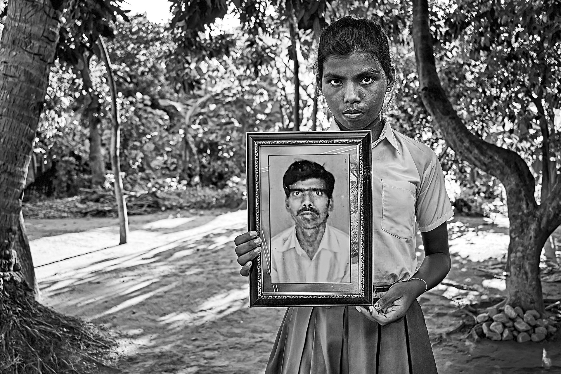
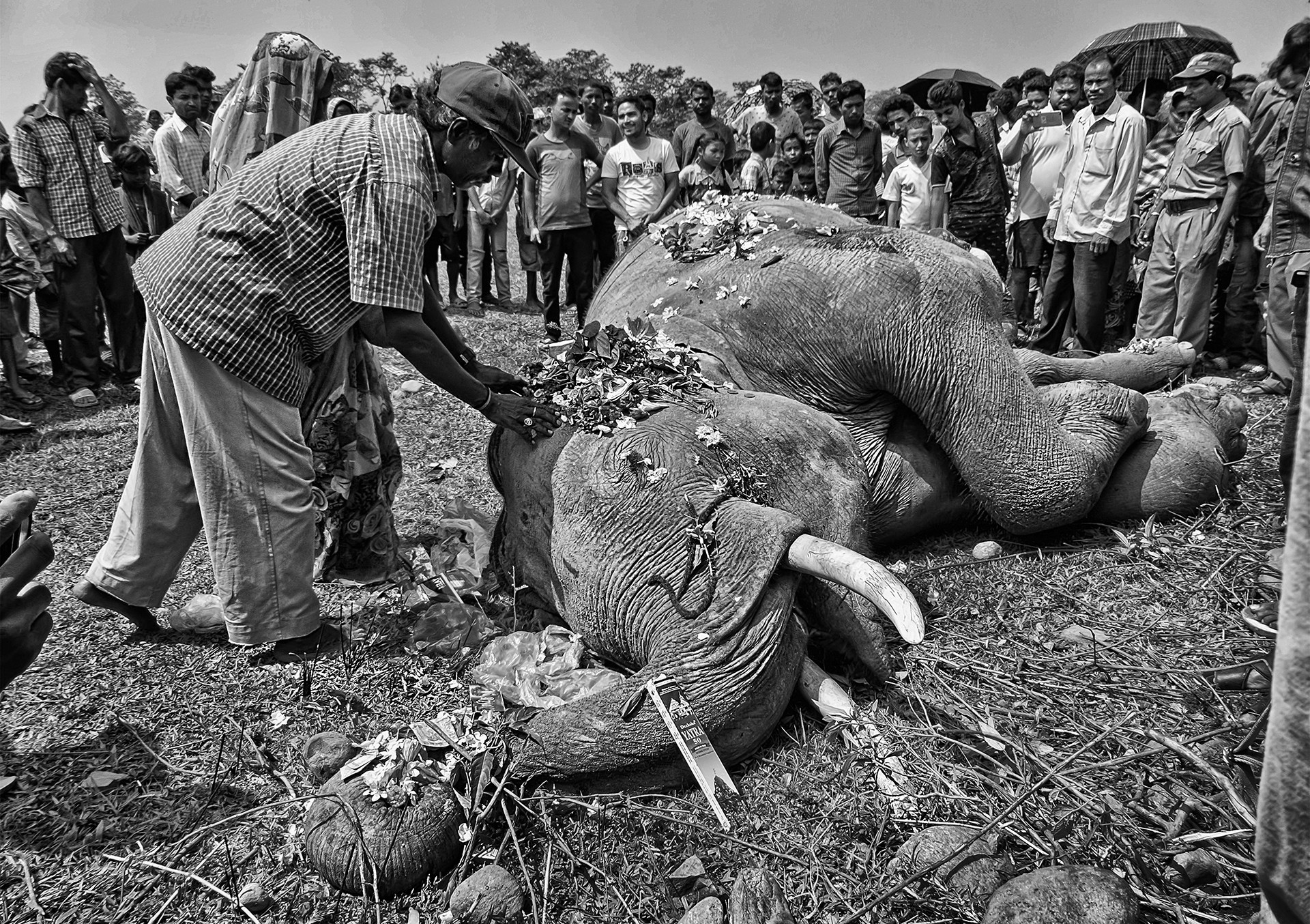
The jeopardisation of this historic route, in turn, pushed these gentle giants towards further human confrontation. The elephants have been forced to find new routes, and as a result, elephant depredation has become higher on the Indian side of the border. Naxalbari, Khoribari, Panitanki, Batashi, Ghospukur, Panighata and Bagdogra became the new faces of human-elephant conflict. Crop and property damage became a regular affair while casualties on both sides kept increasing. Since 2016, more than 25 people have died and at least 20 elephants killed. We call it ‘conflict’, but it is just a means of survival for these animals; they need food and water to survive and we have taken over almost all of their habitats.
The elephants are now using a different route that connects them to Nepal, for which they have to travel a further 17km, creating many more points of conflict. It is clear that the management of human-elephant interactions in the Indo-Nepal border needs the preparation and implementation of a joint action plan by both governing bodies. Transboundary meetings between Nepal and India with respect to human-animal relations need to be carried out regularly, at the local level. We need to conduct detailed surveys to collect adequate data and thereby provide scientific solutions, and also involve the local communities in decision-making. The Indo-Nepal border could be a great example to the world where two countries are working together towards creating an ‘elephant-friendly’ border.