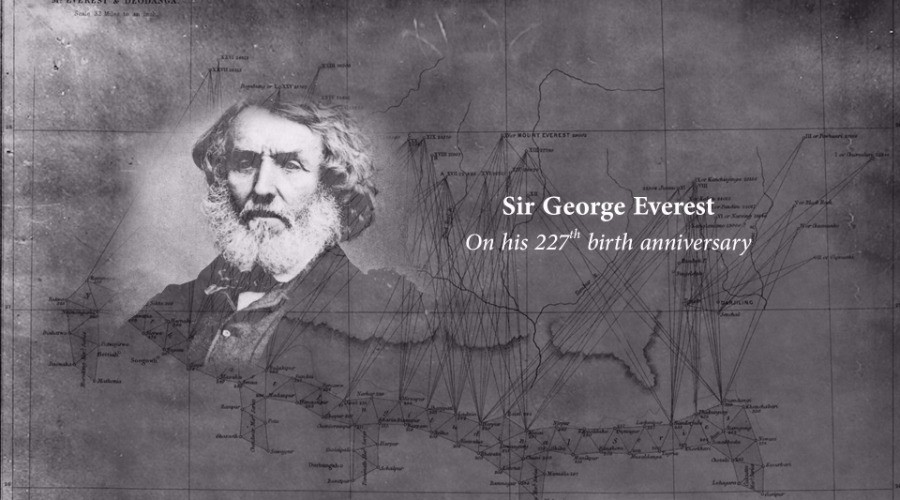
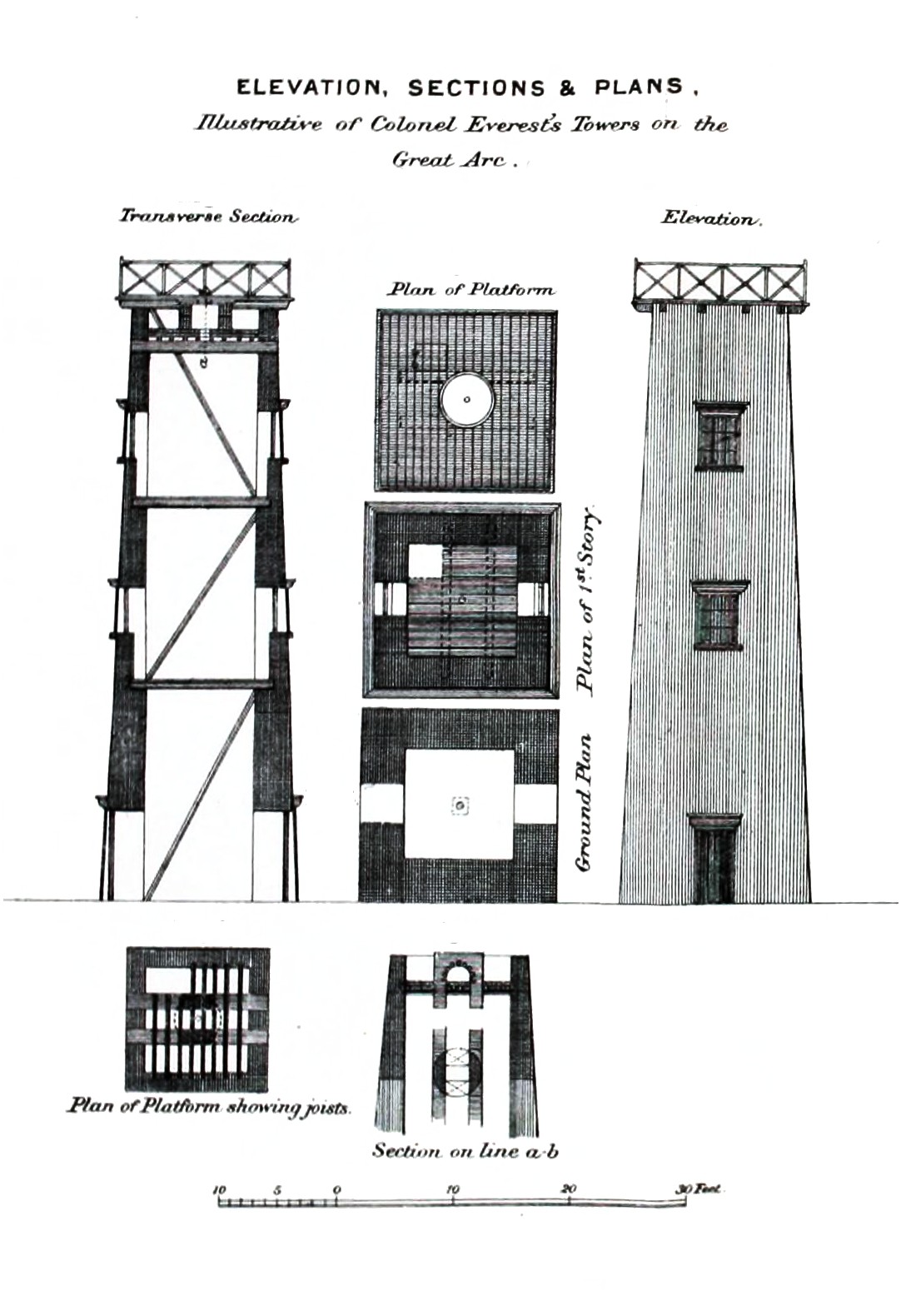
Measuring mountains, creating history – Sir George Everest
On his 227th birth anniversary, Aadya Singh creates a timeline of events in Sir George Everest’s life
On the birth anniversary of a man synonymous with the mightiest mountain we know, we thought we’d take a moment to remember Sir George Everest.
Unbeknownst to most people, Sir George Everest probably never even saw Mount Everest, much less climb it. What’s more, he wasn’t even comfortable with the idea of the mountain being named after him. He did, however, have a number of achievements that deserve recognition, especially today – on his 227th birth anniversary!
1790 – George Everest - pronounced Ee-vurist (/ˈiːvrᵻst/), not Ae-vurist (/ˈɛvərᵻst/) - is born on the 4th of July in Gwernvale, Brecknockshire, in Wales.
1806 – Always interested in a military career, Everest joins the Military Academy in Woolwich at the age of 16, where he excels in math and trigonometry, in particular.
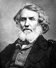
1818 – As Lieutenant Everest, he is commissioned into the Royal Artillery and appointed an assistant to Colonel William Lambton. Under the East India Company, Lambton had begun the Great Trigonometrical Survey of the Indian subcontinent in 1802 to map an arc of 2,400 kilometres from the Himalayas in the north to Cape Comorin (now Kanyakumari) in the south. The exercise would be completed many decades later, in 1871. It included the monumental task of measuring the height of the world’s greatest peaks. Over the years, the survey, which took the team into all kinds of terrain, claimed several lives, usually to tigers and malaria!
Survey towers used in the Great Trigonometrical Survey by George Everest; artist C. Strahan
1823 – Following Lambton’s death, Everest assumes the role of superintendent of the survey.
1825 – He returns to England after falling dangerously ill; works painstakingly for five years to improve the surveying instruments in use, and eventually introduces some of the most accurate surveying instruments of the time. He also works towards having an instrument maker placed in India to save time (the practice then was to send faulty instruments back to England).
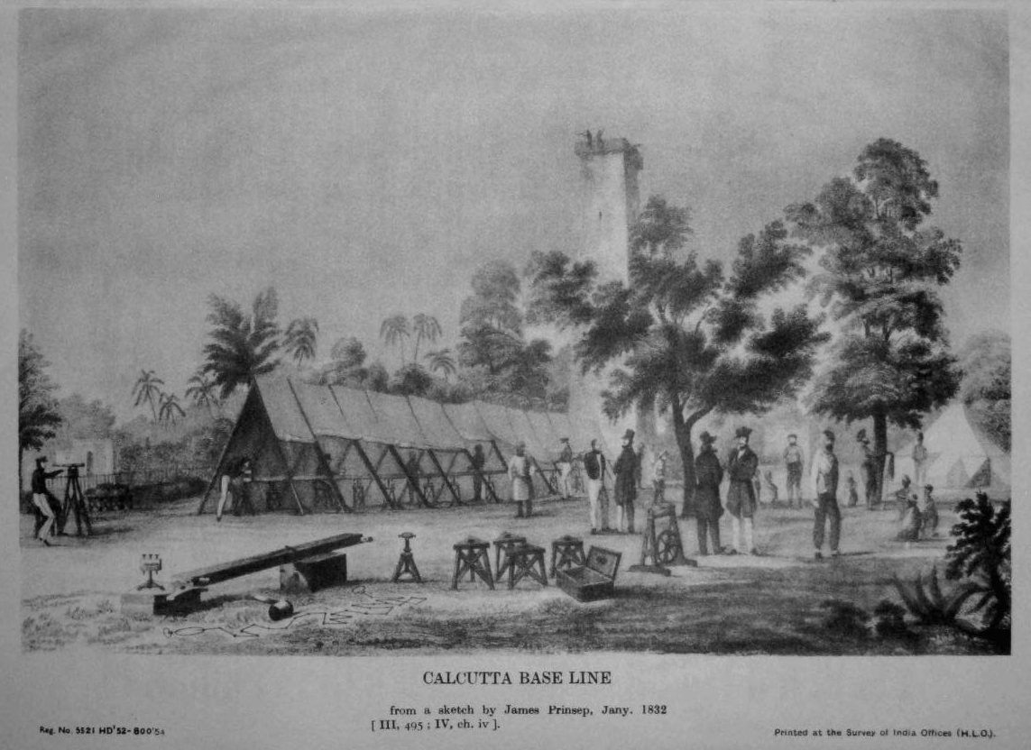
Great Trigonometrical Survey measurement of the Calcutta baseline in 1832 by George Everest. The engraving is based on a sketch by James Prinsep.
1827 – He is elected a Fellow of the Royal Society in England, which is the oldest known society promoting excellence in science.
1830 – In June, Everest returns from England as the Surveyor-General of India. Over the next few years, he maps the longest ever meridian arc surveyed at that time – a mammoth accomplishment. He organises mapping surveys from Dehra Dun in the north to Sironj in Madhya Pradesh: a feat which requires a team with 4 elephants, 30 horses and 42 camels traversing across the dusty plains.
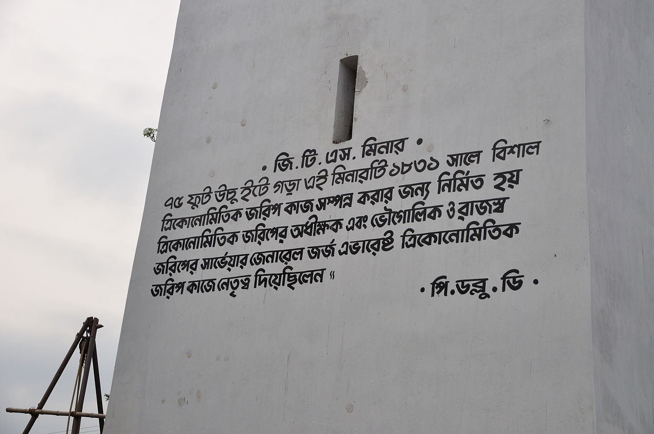
Great Trigonometrical Survey pillar at the North 24 Parganas. Translation: “This 75-feet high brick minar was erected on 1831 CE. Surveyor and geographer George Everest led the Trigonometric Survey.”
1843 – It has taken Everest twenty-five years to complete his work on the Great Meridional Arc and compile the results. He retires and returns to the United Kingdom.
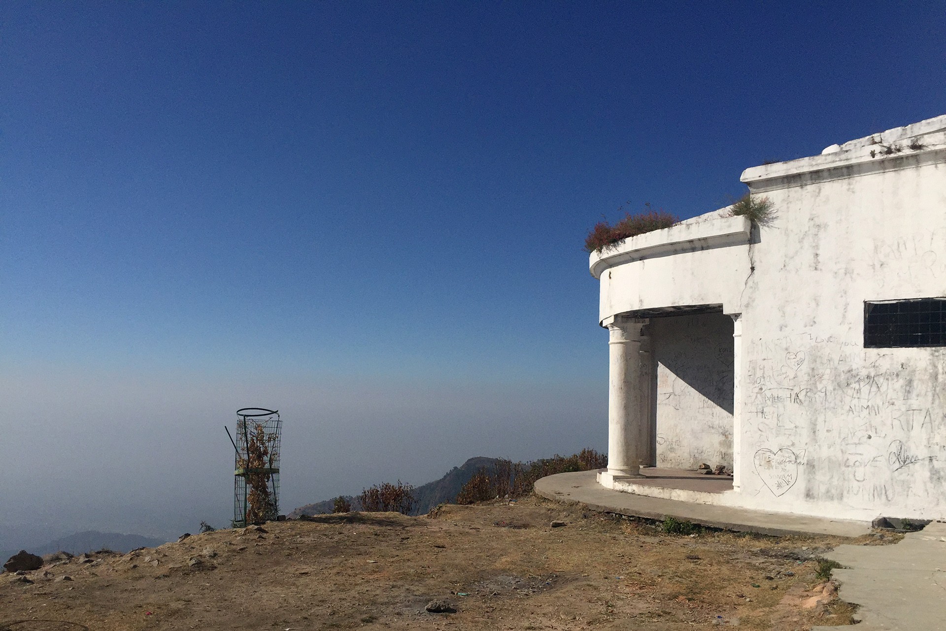
His home, known today as Sir George Everest's House and Laboratory, in Mussoorie. Photograph: Radha Rangarajan
1848 – The Royal Astronomical Society recognises his achievements, stating – “The Great Meridional Arc of India is a trophy of which any nation, or any government of the world would have reason to be proud, and will be one of the most enduring monuments of their power and enlightened regard for the progress of human knowledge.”
1852 – A man named Radhanath Sikdar, a mathematician with the Great Trigonometrical Survey who had the official position of ‘calculator’, thinks he’s come across the highest mountain in the world, higher even than Kanchenjunga, the reigning record-breaker at the time. Everest had once said that Sikdar was one of the greatest mathematicians he’d known. It was confirmed several years later that Sikdar had indeed stumbled upon the world’s highest peak, known then as Peak XV. In fact, it is still growing, vying to keep its record, and stands at 29,035 feet (8,850 metres) today.
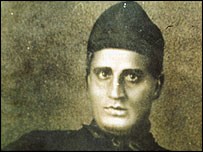
Radhanath Sikdar, the mathematician who calculated the height of Mount Everest
1857 – Everest opposes the naming of ‘Peak XV’ after him, telling the Royal Geographical Society that Indians would not be able to pronounce his name (he was probably right!) and that “Everest” couldn’t be written in Hindi.
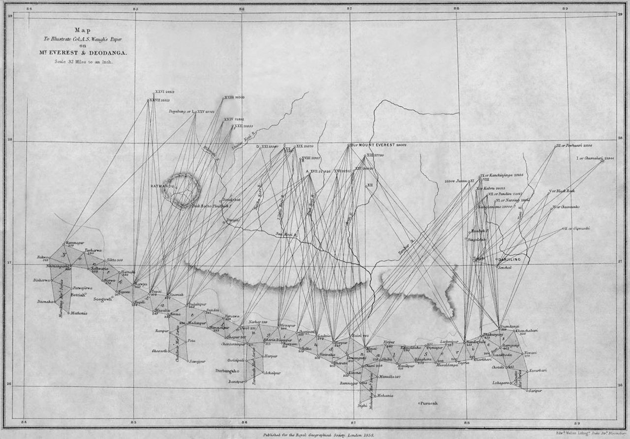
Triangulation along the Himalayas and bearings of its peaks; artist Andrew Waugh (1810-1878)
1861– Now knighted, he becomes known as Sir George Everest.
1862 – He is elected the vice-president of the Royal Geographical Society.
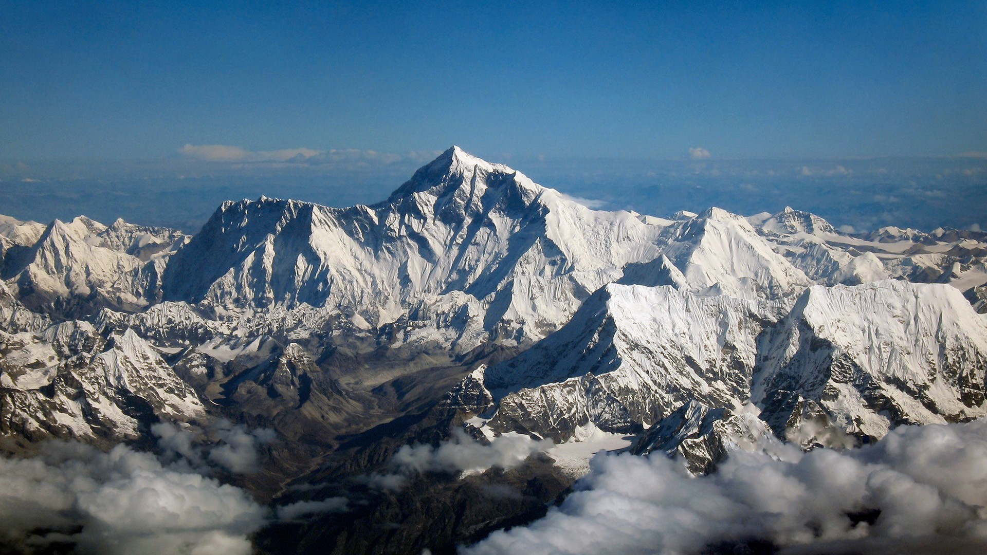
The Everest peak, as seen from the air
1865 – Despite Everest’s discomfort with the nomenclature, the mountain formerly known as Peak XV was renamed after him by then-surveyor general Colonel Andrew Waugh, who admired and greatly respected Everest. Waugh felt that since the peak had a large number of different local names, it would be hard to favour one over the other:
“I was taught by my respected chief and predecessor, Colonel Sir George Everest to assign to every geographical object its true local or native appellation. But here is a mountain, most probably the highest in the world, without any local name that we can discover, whose native appellation, if it has any, will not very likely be ascertained before we are allowed to penetrate into Nepal. In the meantime the privilege as well as the duty devolves on me to assign…a name whereby it may be known among citizens and geographers and become a household word among civilized nations.”
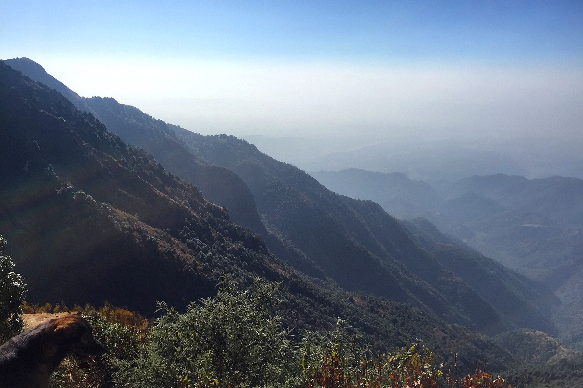 Another location that’s become synonymous with his name; this valley is often referred to, simply, as “George Everest” in Mussoorie and is known for its trekking routes. Photograph: Radha Rangarajan
1866 – Everest dies in London on the 1st of December.
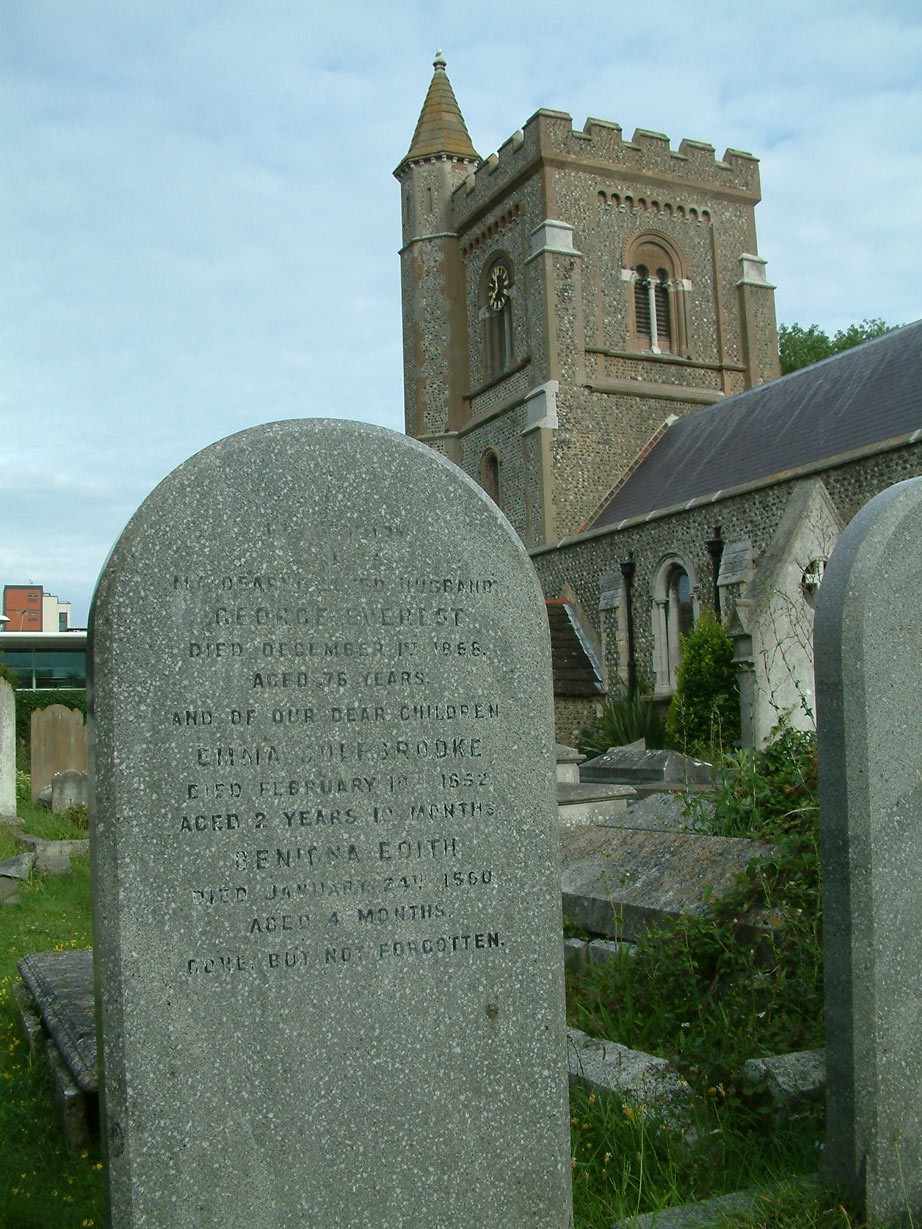
Everest's grave in St Andrew's Church, Hove, near Brighton
Everest’s nomenclature continues to be contested even today. Till this day, Peak XV is known as Sagarmatha in Nepal, Deodungha in Darjeeling, Zhumulangma by the Chinese, and Qomolangma by the Tibetans.
All photographs courtesy Wikimedia Commons